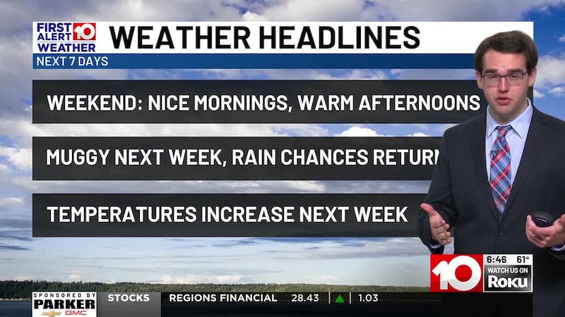
Warm and Dry Weekend!
Humidity and rain chances increase next week
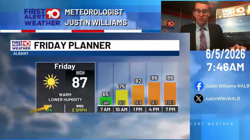
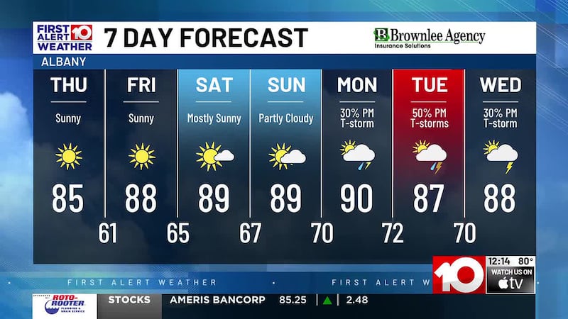
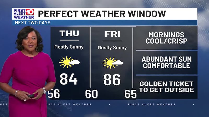
TODAY: A nice warm up is expected! Out the door temperatures will be in the upper 50s and low 60s. Sunny skies bring a big warm up, temperatures reach into the 80s by lunch time and into the upper 80s near 90 for your high in the mid-late afternoon.
SATURDAY: A refreshing morning with temperatures in the low-mid 60s. Temperatures quickly warm again, highs reach to near 90 with mostly sunny skies.
SUNDAY - MONDAY: Humidity increases and we start getting muggy again. Afternoon temperatures linger near 90° while overnight lows steadily increase into the low 70s.
TUESDAY - END OF NEXT WEEK: Temperatures don’t change much through this time frame. Highs around 90° and lows around 70°. High humidity will introduce a slight rain chance each day. Heat indices push into the mid-upper 90s.
TROPICS: Models forecast the Gulf and Caribbean to come alive over the next week or two. Most long term models show at least some kind of tropical development late next week. Rain from this potential tropical system will be possible in South Georgia late next week as a result, but impacts are extremely uncertain at this time. We will continue to monitor this over the next couple of days.
To stay updated on all the latest forecasts and weather, follow WALB News 10 Weather on Facebook and X (Twitter).
Click here to see all the latest weather headlines and here to view the First Alert Radar. To keep up with all things South Georgia weather, click to download the WALB First Alert Weather app on the Apple App Store and the Google Play Store.
Copyright 2026 WALB. All rights reserved.